Understanding and documenting a site’s existing conditions is a critical first step in the early stages of conceptual design. It’s essential for ensuring that your design solution is not only sustainable but also contextually sensitive and relevant. Autodesk Forma steps in here as a pivotal tool, making the gathering of contextual site data during these early planning stages not just insightful, but impressively straightforward.
Autodesk Forma is designed to streamline the process of site data collection and integration. It offers a world wide range of contextual information from topography, buildings geometry, road data, parcel boundaries, to satellite imagery. This data is meticulously sourced from a global network of providers, ensuring that you have access to accurate and locally relevant information, no matter where your project is located.
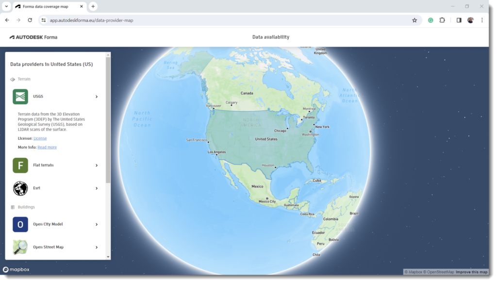
Forma Data Coverage App
To check the availability contextual information in your project location, we have released the Forma data coverage web-app that it allows you to check the range of regional data sources available. Access the app at https://app.autodeskforma.eu/data-provider-map
Unless otherwise noted, the baseline source when no other local dataset is available is summarized in the following table:
| Data | Source | Resolution |
| Building footprints | Open Street Map | varies |
| Road data | Open Street Map | varies |
| Terrain (Europe) | EU-DEM | 25 m |
| Terrain (global) | ASTER GDEM | 30 m |
| Map texture | Mapbox | varies |
| Satellite images | Mapbox | varies |
| Weather data | ERAS C3S | hourly |
Since open source data is dependent on contributors input, the coverage and quality varies across the world. For example, most buildings in Open Street Map lack heights. For these buildings, Forma estimates building height in meters, calculated at 3 meters per level, if no height data is present, assuming at least 1 level per building. For that reason, we recommend that you double check the accuracy of project data with surveyed information.
Order Contextual Data
The Library Panel in Forma is a gateway to a vast selection of regional data sources, currently available at no additional cost. With the expansion of the network to encompass private data providers, a fee structure may be introduced to reflect this broader range of offerings.
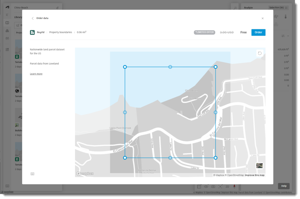
The Project Library in Forma displays a list of all ordered data. Incorporate the dataset in your proposal using the “Place in Canvas” function. Contextual data is categorized under the ‘Base Layers’ section in the Project Navigator. Editing layers within a Base or adding new ones will update all proposals using that base.
Data Conversion from Forma to Revit
The Forma Add-in for Revit, available in the Autodesk app store, serves as a conduit for transferring Forma contextual data into Revit for further design documentation.
Use the “Send to Revit” capability in Forma to make all the context layers readily available in Revit. Then, create a new Revit project, and use the “Load Proposal” feature to download the context data. The Forma Add-in establish a unique link to a Forma proposal.conte
The base layers from Forma are accurately mapped to corresponding Revit categories as follows:
Coordinate System: The UTM GIS coordinate system from Forma overrides Revit’s shared coordinate, which guarantees precise site alignment. You can always reset the coordinate system in Revit afterwards if you want to use your own shared coordinate specifications.
Terrain: The December 2023 release of the Forma Add-In introduces enhanced features for Toposolids. This includes new options for creating subdivisions based on parcel, road, and site boundaries, enriching the visual representation of the terrain.
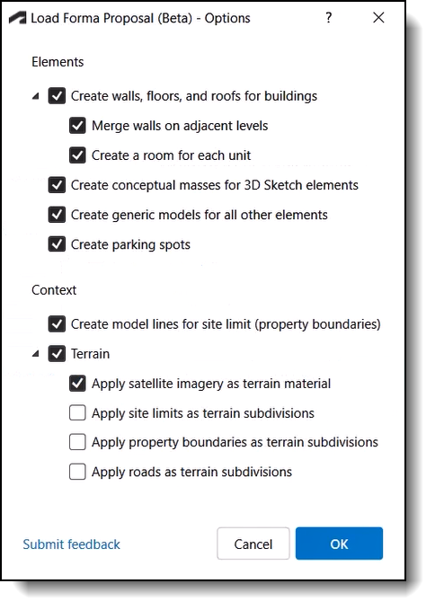
Buildings: Converted into Generic Model instances under a single Model Group.
Site limits: The site boundaries – which mark the extents of the analytic metrics in Forma- are converted to Model Lines of the ‘Site limit’ linestyle and hosted as flat lines in the upper most level in Revit. You can edit the graphic properties of the linestyle to fit your visual needs.
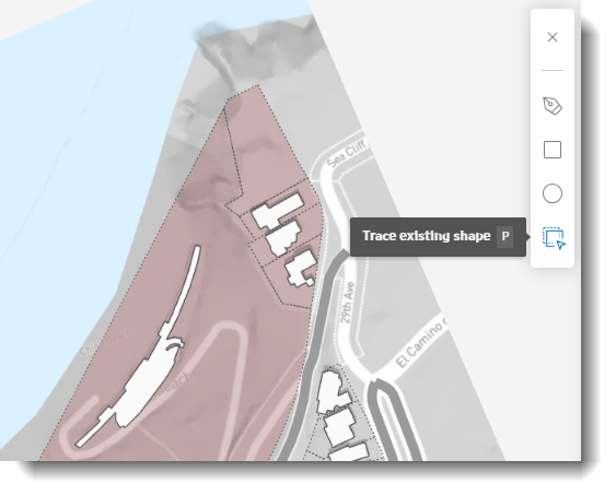
Property lines: Translation functionality of property lines is currently under development and will be included in a future update of the AddIn. As a workaround, you can trace the limits of your site by picking parcels and make property lines travel as Model Lines. You can also use a Dynamo script to project the Site limits onto the topography surface. Download the dyn file here (Dynamo 2.19).
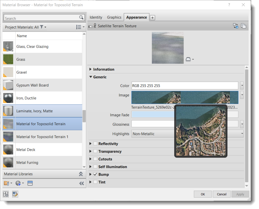
Aerial Maps: Aerial images travel to Revit as a material texture wrapping the new Toposolid type.
The Outcome: A Contextually Integrated Design
The result of this integration is a robust site canvas that paves the way for a sustainable, contextually integrated design solution.
The use of site data from Autodesk Forma enhances the documentation process, ensuring designs are sustainable, context-aware, and fully integrated with their surroundings.