Autodesk Forma, available in the AEC Collection or as a standalone subscription, offers powerful AI-powered tools for architects and designers in pre-design and schematic design phases.
The new ArcGIS for Autodesk Forma app combines Autodesk Forma’s intuitive planning, design, and analysis tools with powerful geographic information system (GIS) data from Esri’s ArcGIS Online and ArcGIS Enterprise platforms. Architects, engineers, and designers can now access integrated geographic data in Forma, gaining a holistic understanding of how their projects interact with social, built, and natural environments–no GIS expertise required. This streamlines site analysis and environmental impact assessment, enabling more informed decisions and effective designs.
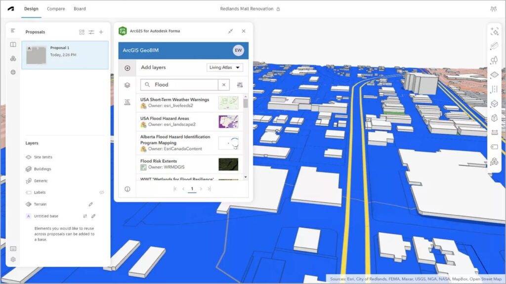
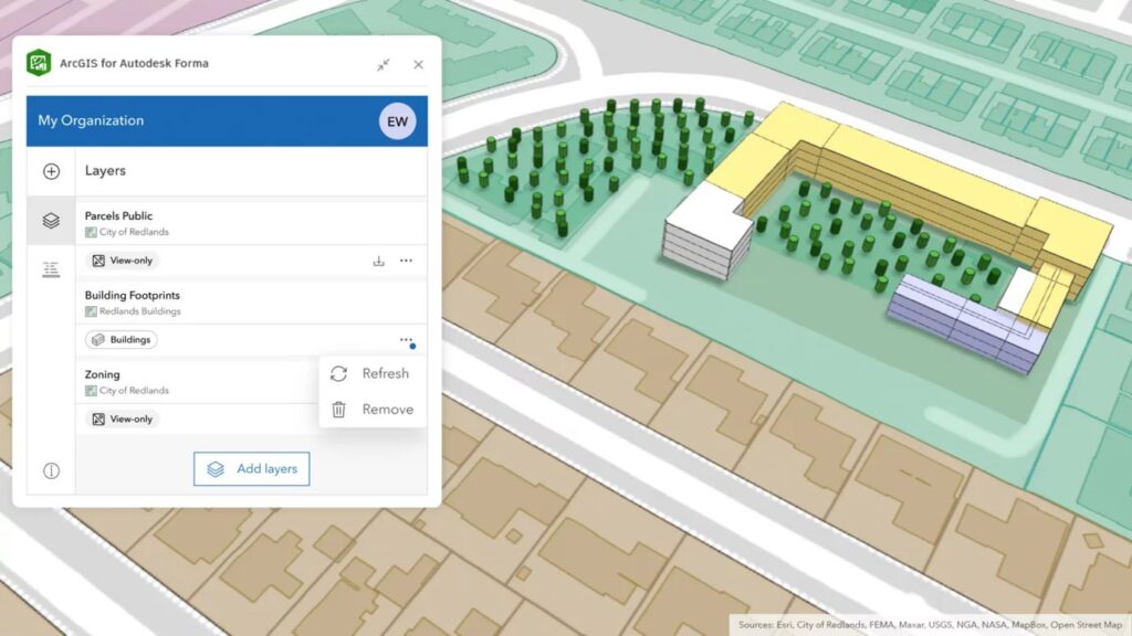
Along with proprietary data, users have access to ArcGIS basemaps and select data layers from ArcGIS Living Atlas of the World—the foremost collection of globally sourced geographic information. Available data layers include environmental features such as soils and hydrology, built infrastructure, imagery, and real-time feeds.
Forma meets ArcGIS: how does this enhance the workflow now in Forma?
Users can now enrich their Forma proposals with real-world context–think boundaries, roads, infrastructure, geological data, natural resources, and more. This comprehensive view empowers designers to make more informed decisions earlier. Plus, they can fast-track the detailed design process by sending their georeferenced Forma proposal directly to Revit, complete with integrated GIS data.
Why is this important in the concept design phase?
As projects grow more complex, having more detailed site information for site analysis upfront gives design teams a crucial head start. This accelerates informed decision-making regarding, for example, site constraints, regulations, risk management, and sustainability. Design changes can be easily made while there’s still flexibility, reducing the risk of having to implement high-cost fixes and delays after the design is finalized.
How does it help architects, engineers and designers improve their day-to-day work during the concept design phase?
1. Connected workflow: This seamless workflow makes it easier for users to incorporate and analyze geographic data in their designs without needing to switch between multiple tools. With the necessary data and design tools accessible in one place, this saves time and reduces rework.
2. Informed decision-making with contextual information from day one: Integrating rich, spatial context into your design environment ensures projects are guided by relevant and up-to-date geographic data from zoning and terrain to population density and biodiversity data. Early use of geographic and land-use data ensures compliance with local regulations, speeding up approvals. The data also allows for early and proactive identification of risk, preventing costly reworks and delays later down the line.
3. Enhanced visualization: Integrated geographic data boosts design storytelling by enhancing visualization of how designs interact with surroundings and validating design decisions. This makes presentations more compelling and clearer for clients and stakeholders to understand, fostering more informed discussions.
4. Improved collaboration: Shared access to integrated geographic and design data improves team collaboration as everyone works from the same model. This streamlines communication and coordination, keeping everyone on the same page.
To access the extension, open your proposal in Autodesk Forma and select Extensions. Choose ArcGIS for Autodesk Forma, sign in to your ArcGIS Online or ArcGIS Enterprise account, and you’re ready to go. An ArcGIS Online or ArcGIS Enterprise account is required to access the extension.
With Esri’s ArcGIS data integrated in Forma, design teams now have easier access to more of the contextual data they need to deliver future-proof projects that drive better business outcomes and meet sustainability and resiliency goals.
Read the full press release about the launch of the ArcGIS for Autodesk Forma app here.