After having the most exciting time at this year’s Autodesk University, team Forma is back fully energized and ready to innovate further! But first, let’s do a quick recap of the Forma related highlights from AU. Whether you caught us live at the event or not, there’s plenty for us to unpack:
Here are the most prominent Autodesk Forma updates announced at #AU2024:
1. Forma x Autodesk Docs
Autodesk Forma is now connected to Autodesk Docs, Autodesk’s AECO data repository, enabling new experiences for the industry. Excitingly, the first capability of this new connection is already available in the Forma Board.
Powered by this new connection, the Forma Board—a digital whiteboard—can now visualize designs and models created throughout the entire AECO lifecycle, and not just those made in Forma. This enhancement promotes improved collaboration and informed discussions among all stakeholders, including architects, engineers, contractors, and so on.
There are many new capabilities in development, enabled by this connection between Forma and Docs. Stay tuned!
Learn more about the Forma and Autodesk Docs connection here: https://adsknews.autodesk.com/en/news/autodesk-doubles-down-on-the-future-of-bim/
2. Enhanced integration between Autodesk Forma and ESRI
In addition to Esri’s terrain data, already available within Autodesk Forma, at AU 2024 Esri and Autodesk announced plans to incorporate a wide array of contextual geographic data from ArcGIS, including both Esri and consensually shared customer data for buildings, zoning, roads, property boundaries, imagery and more.
With contextual data at their fingertips, architects and planners using Forma will be able to gather insights earlier in the design process to create a launch pad for new BIM projects, and design with location in mind, all allowing for more informed planning decisions.
Additionally, this integration will also empower GIS teams and architects with continuous collaboration, fast data access, and iterative feedback, helping teams take an outcome-driven approach that leads to improved project outcomes.
Here are some thoughts from an early tester of the upcoming ArcGIS extension:
“My experience with the ArcGIS Extension for Forma is that it is familiar and easy to use for an active ArcGIS online user. The functionality seems very similar and intuitive to me. The extension will make it easier to obtain more information about the site in the early phases of a project, such as governmental WMS-layers like landslide zones, nature, flooding zones, zoning, and much more. Additionally, one’s own geo-referenced drawings and mappings can also be easily incorporated into Forma. For me, as a spatial planner, this makes Forma more valuable.”
Christian Dunker Furuly, Spatial Planner at Henning Larsen
We’ll keep you informed as this functionality rolls out to all Forma users. Watch this space to stay updated.
3. Dynamo service integration for Autodesk Forma
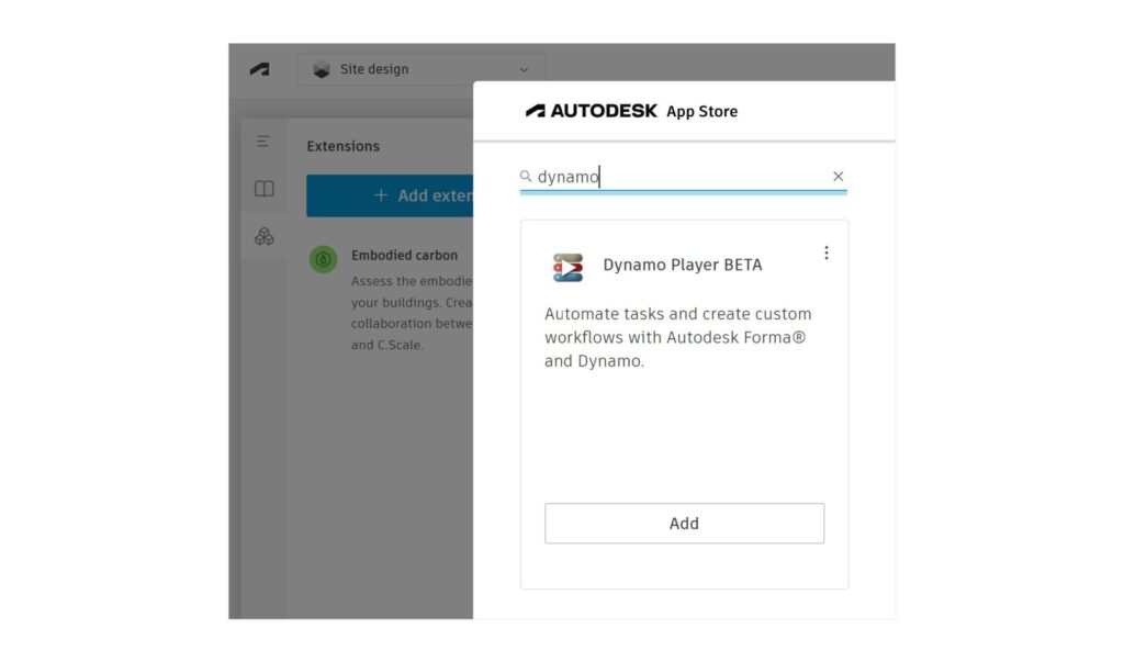
In the AECO keynote at AU, we also introduced a closed beta Dynamo service integration with Autodesk Forma.
This allows Forma users to access and share Dynamo’s custom automation and analysis tools without needing a Dynamo development environment. This latest capability will bring powerful new functionality to Forma users without the need of in-depth technical expertise, while also having the option to create and distribute their own automations and tools.
Learn more about this integration here: https://dynamobim.org/dynamo-as-a-service-powers-up-dynamo-player-in-forma/

4. Spotlighting the latest Forma extensions from AU week
- Archistar 3D Generative Design extension
This extension, designed by Archistar.ai for architects, urban planners, and property developers, enables users to rapidly generate optimized 3D designs in Autodesk Forma. It caters to a variety of development types, including low-density housing, medium-density apartments, commercial spaces, and more.
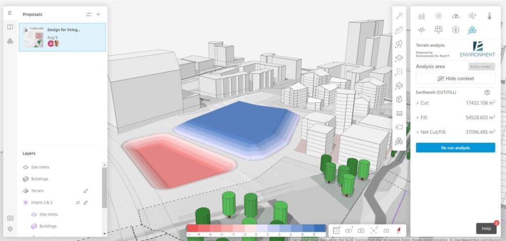
- Terrain Analysis extension powered by Environment for REVIT®
This newly launched extension empowers Forma users to gain deeper insights into their project’s terrain conditions and the effects of terrain modification. It allows users to effortlessly determine the volumes of soil required for earthworks and provides them with the graphical representation of the cut and fill amount needed based on their project.

If you’re interested in learning in detail about these exciting capabilities and more, we strongly encourage you to watch the “What’s new in Forma – November 2024” webinar session that is now available on-demand. In this session, we walk you through all the latest updates in Forma since June 2024 and equip you with tips and tricks to make the most of them. Be sure to sign up, we’ll see you there!